

GOLDEN TRIANGLE
The Golden Triangle Tour is one of the...


Time:
Distance:
Elevation Leh : 3500m
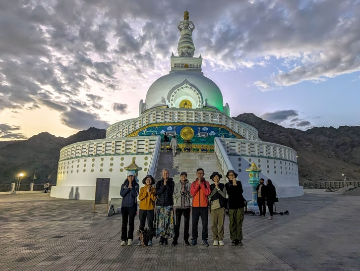
Upon arrival in Leh, check in at your hotel and take the day to rest and acclimatize to the high altitude. In the evening, head out to visit Shanti Stupa, Tsemo Monastery and Leh Market. Overnight stay at Deluxe Hotel.
Time: 3hrs Drive
Distance: 140km
Elevation Lamayuru : 3550m
On this day, we’ll enjoy a scenic drive through Ladakh, visiting the 1,000-year-old Alchi Monastery, renowned for its ancient art and serene atmosphere. Continuing onward, we head to Lamayuru, famous for its dramatic, moon-like landscapes—often called Moonland. Along the way, we’ll pause at stunning viewpoints, including the iconic confluence of the Indus and Zanskar Rivers, where the two mighty waterways meet. The day concludes with an overnight stay at a hotel in Lamayuru.
Time: 3-4hrs trek
Distance: 8 km
Elevation: gain/ loss: +182m/ -m
we take an acclimatization hike from Lamayuru to Wanla, crossing the scenic Prinkiti La 3732m Pass. The trek lasts about 3–4 hours and offers beautiful views of the surrounding landscape. From Wanla, we drive back to Leh, stopping en route to explore the historic Saspol Caves before returning to the city
Time: 5 hrs Trek / 2 Hrs Drive
Distance: 12.4 km
Elevation gain / loss: +340m / -0m
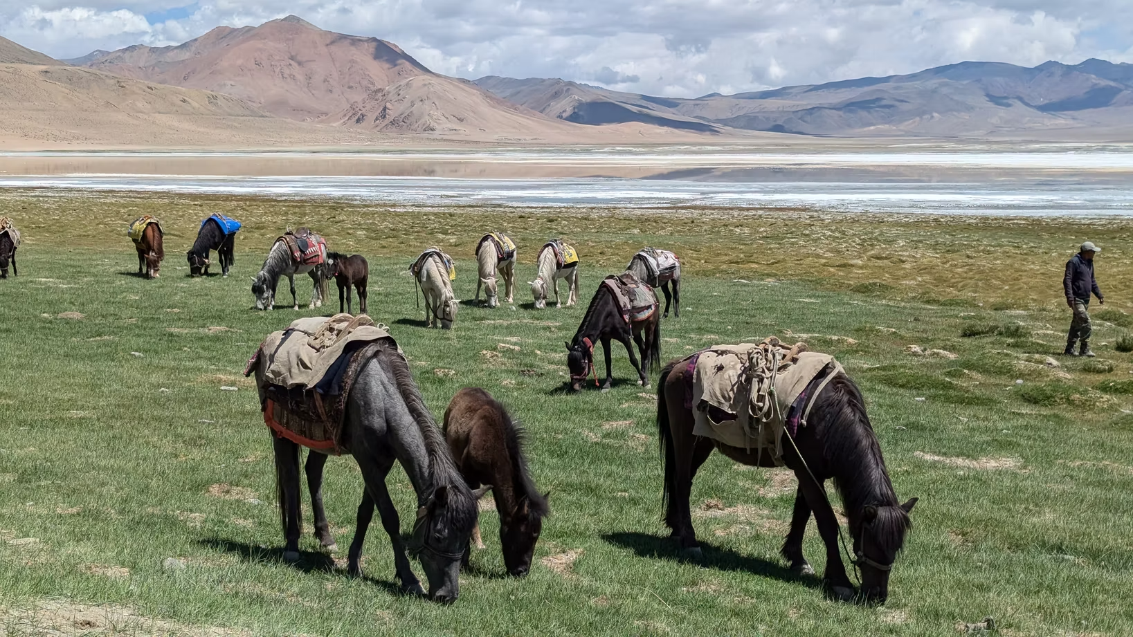
Today start drive to the Rumtse trekking point and meeting your kitchen team and horseman, you begin your trek. The trail starts on a dusty path that curves into Kyamar Valley, passing the confluence of Chhaba Chu and Kyamar Stream. You’ll cross a few easy rivulets and walk through green marshlands before following a gentle left trail toward Kyamar.The route is mostly flat, shifting from marshy ground to gravel as the valley widens. After walking for about an hour, the green marshes reappear along the Kyamar Stream, marking your arrival at the Kyamar campsite(4580m).
Time: 7-8 hrs
Distance: 12.1 km
Elevation gain / loss: +630m / -270m
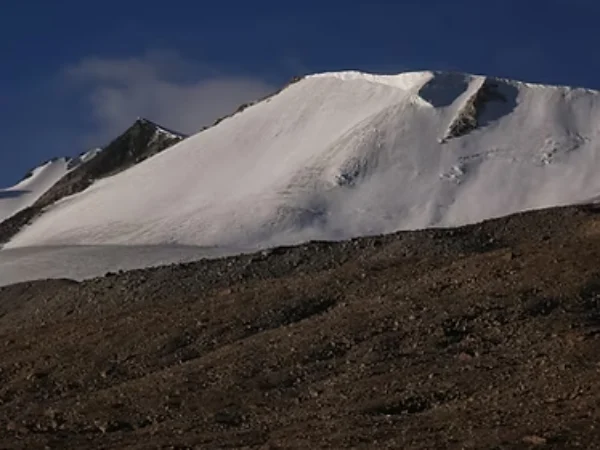
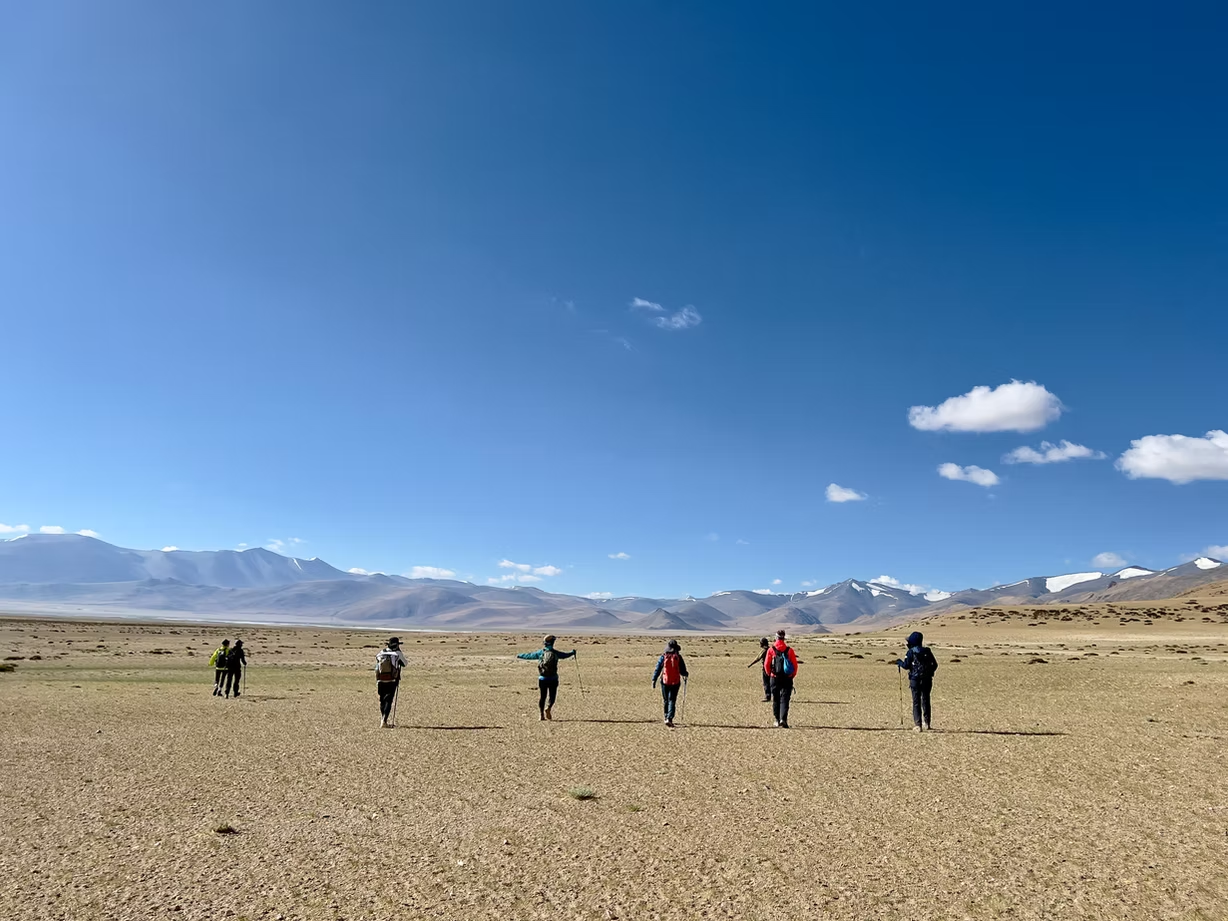
Today’s trail begins with a gradual ascent toward the base of Kyamar La. After a 20-minute walk, you’ll reach the center of the valley, where you follow a wide SUV track leading to the pass. It takes about an hour to reach the base, where a small stone bridge crosses the Kyamar Stream. After crossing, the trail climbs steeply, winding its way upward toward Kyamar La. The final stretch is beautifully dotted with tiny wildflowers, offering a gentle contrast to the challenging terrain.This is one of the tougher days of the trek, as you will cross two high passes. The first, Kyamar La (5,100 m), is followed by a gradual descent of about 200 meters before the trail rises again toward the second pass, Mandalchan La (5,200 m). From Mandalchan La, the route levels out for about 20 minutes before descending steadily to the campsite at 4,940 meters.
Time: 5-6 hrs
Distance: 15km
Elevation gain / loss: +335m / -725m
start early in the morning to avoid the brutal afternoon sun. The initial part of the trek involves a steady 1.5km climb to Shibuk La(5250m), which is adjacent to the campsite. The altitude gain is around 1,000 feet. Cross the stream and head to the base of Shibuk La. The trail moves south-east and the pass is clearly visible above. There are several ways to reach the summit. The straight route requires you to cross the stream towards your left and make a straight line upwards to the summit. This route is the shortest. However, the route has the maximum incline and is strenuous. The other way to go about it is to take the left side trail and reach the crest of the pass. This is a longer route but the ascent is gradual, at least initially. It takes about an hour and half to reach Shibuk La. The valley widens as you walk towards Nuruchen, a Changpa village. Looming ahead are towering Zanskar ranges, where you can easily spot the Horlam La ridge. It’s an easy but long walk all the way to Ponganagu (4550m).
Time: 5-6 hrs
Distance: 16.5 km
Elevation gain / loss: +129m / -m
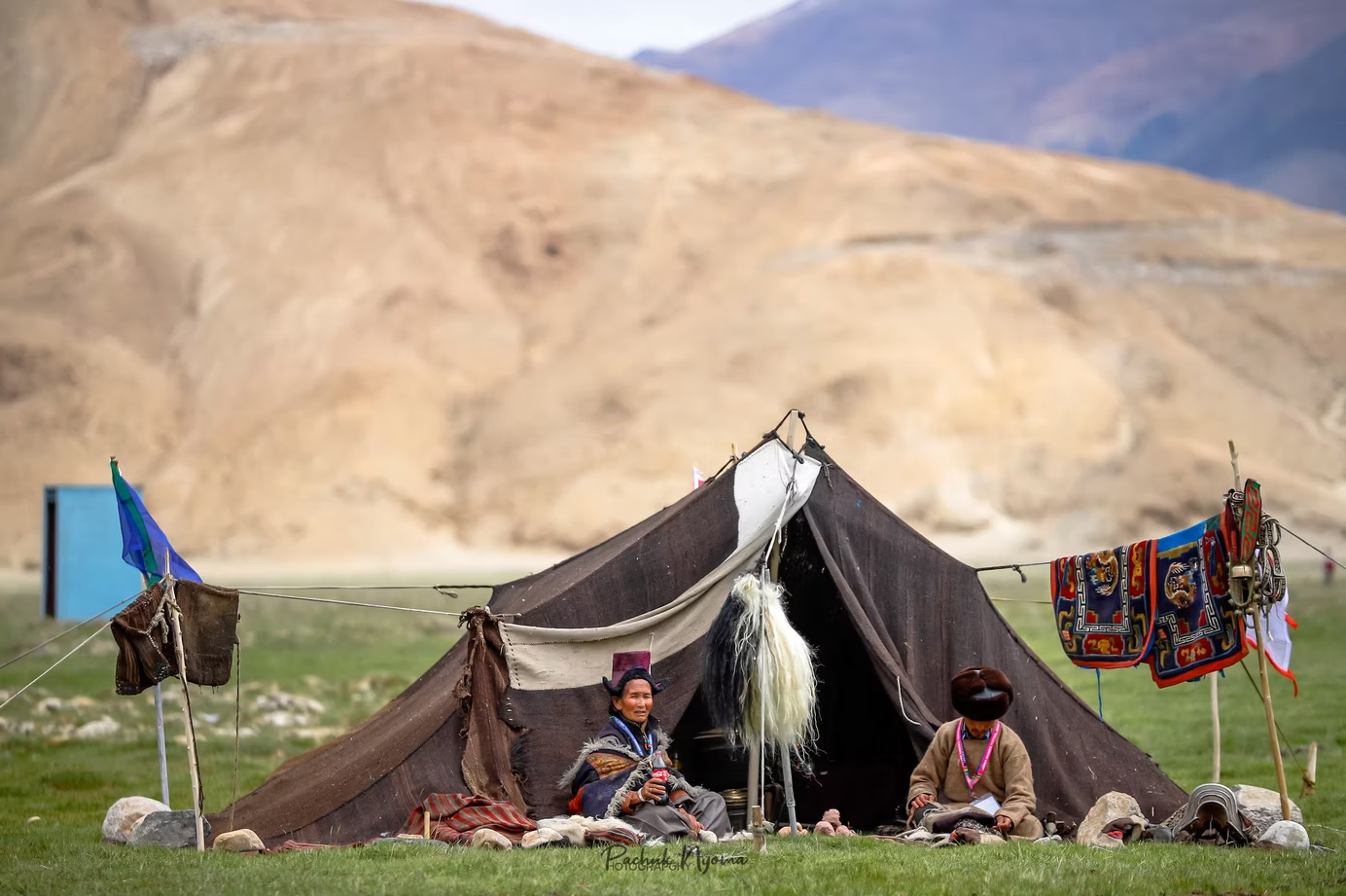
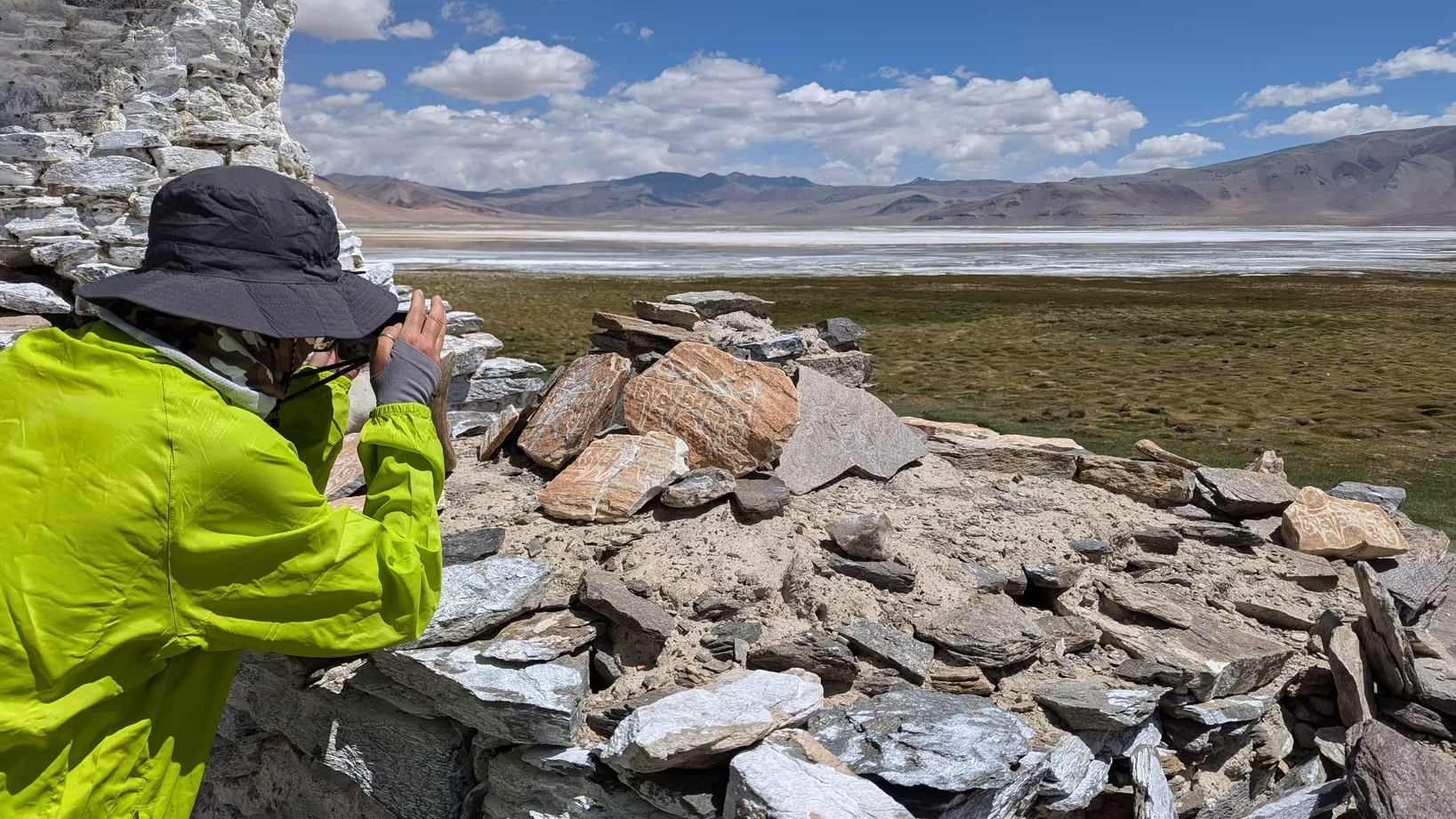
The valley widens as you walk towards Nuruchen, a Changpa village. Looming ahead are towering Zanskar ranges, where you can easily spot the Horlam La ridge. It’s an easy but long walk all the way to Nuruchen, Nuruchen is used as a safe haven during bone-chilling winters by the Changpas. In the summers it looks like a ghost village with abandoned huts. There is a muddy stream gushing down from the Horlam La ridge, from the south west side. The rivulet is known as Nuruchen Lungpa and drains into the Tso Kar Lake. Pitch tents near the stream for the night.
Time: 3-4 hrs
Distance: 9 km
Elevation gain / loss: +271m / -m
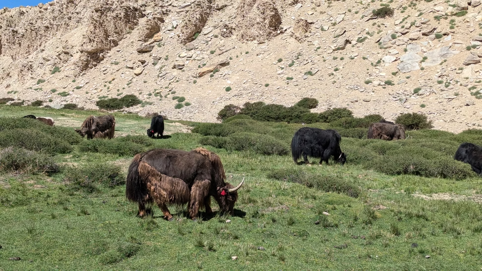
Start our trek towards the Tibetan nomadic settlement of Rajun Karu with a gradual ascend crisscrossing streams along the way. The trail is along a meandering river with snowy mountains on either side. The Changthang valley unveils its extravagant scenery from this point onwards. Prepare for abrupt weather conditions and be equipped with rainproof jackets and covers for your bag. After a steady but steep incline followed by a descent to Rajun Karu you get to witness many camps of the Changthang nomads with Yaks and Pashmina Goats grazing on the pastures.
Time: 8-9 hrs
Distance: 15.2 km
Elevation gain / loss: +480m / -240m
Today’s trail crosses the challenging Kyamayuri La (5400m), followed by a gentle descent to stunning Gyamar Barma—one of the trek’s most scenic and windiest campsites, surrounded by dramatic peaks. After interacting with Changthang nomads, continue across the river and ascend the steep Kartse La(5410m). Enjoy sweeping views of valleys, rivers, and grazing wildlife before descending to the stream-filled Gyamar campsite.
Time: 7-8 hrs
Distance: 14.1 km
Elevation gain / loss: +280m / -840m
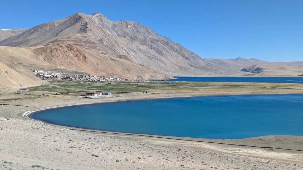
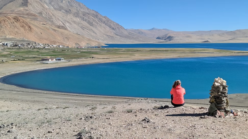
Today marks the longest and most challenging section of the trek. The trail from Gyamar begins with a steady but lengthy ascent toward Yalung Nyau La (5,450 m), following a river through dramatic jagged mountains. After multiple river crossings, a sharp turn leads to a steeper climb that finally brings you to the pass—where the first breathtaking view of Tso Moriri’s deep blue waters awaits.From the pass, a steep descent over rugged terrain gradually eases into flatter ground as you approach Karzok, the endpoint of the trek. The mesmerizing freshwater lake of Tso Moriri, framed by towering mountains, offers a serene finale to your journey. Spend time walking along its shores and soaking in the peaceful beauty of this high-altitude gem. Overnight stay at Korzok Phu Camp (4650m).
Time: 5 hrs
Distance: 220 km
Elevation Leh : 3500m
Today marks the final day of your tour. Enjoy a relaxed morning and, after breakfast, spend some time by the serene shores of Tso Moriri—taking photos and soaking in the peaceful atmosphere. Later, begin the drive back to Leh, covering 220 km on mostly smooth, black-topped roads. En route, stop to visit the natural hot springs before continuing to reach Leh by afternoon. The rest of the evening is yours to explore the markets and enjoy some last-minute shopping.
1440 USD / Per Person (Group Trek)


These trips are a better choice after the NOMADIC TRAILS